Saturday, September 27, 2008

Scenic State Park

Scenic is a nice little state park about 45 minutes northwest of Grand Rapids, kind of on my way home from Voyageurs National Park. The campground was mostly empty when I pulled in early Friday afternoon. I stupidly picked a campsite close to the only open shower/bathroom because it seemed convenient and quiet. When people started arriving for the weekend, I realized my error but was too lazy to pick up and move.

After giving up on my afternoon nap, I went up to the park lodge. It's an historic structure built by the CCC back in the 30s. There are a couple other buildings scattered around the area from the same timeframe, including a cabin for overnight rent.


I boiled some water and looked at the interpretative displays while waiting for my food to rehydrate. The lodge has a big fireplace and lots of stuffed animals. It's a pretty cool place to spend a couple hours.


Sunset was incredible - the sky was on fire like I've rarely seen. Unfortunately, the view to the west was almost completely blocked by forest, so I had to settle for a non-fiery shot of Coon Lake to the east.


All those clouds brought in some rain - thanks to that, the campground was pretty quiet and I got some decent rest. Morning brought clear skies and cooler temps. I hiked the Chase Point trail and a loop past Pine Lake. I can't say either trail was spectacular, but it was nice to be out and see a new area. The fall colors were best along the main park road.


Rest of my photos are here.

Voyaguers - Kayaking

After a good night's sleep in International Falls and some major repacking, I was good to go for a kayaking trip. I felt comfortable with a 2 night trip - long enough to get out there and experience it, but not so long I could get myself into too much trouble. Little did I know how wrong I was.

All of my pre-trip planning was based on renting a kayak in Crane Lake and doing a big loop through Crane, Sand Point and Namakan Lakes, with one portage at Grassy Bay. (If you're familiar with the park, this probably makes sense. If not, just ignore the details, nod your head and smile.) However, I didn't want to do a 2-nighter from Crane Lake for various reasons which escape me now but made sense at the time.

I also didn't want to rent a kayak from a resort on Kabetogama - that's some serious big water and the winds were 10-20 mph from the west, so the lake would be pretty tough for a newbie like me to deal with. That left Ash River as my one real option. And unfortunately the one place that rents in Ash River had cheap rental-type kayaks. The ones with no spray skirt or rudder, leaving me with an open cockpit and a boat that didn't track very well. I thought this would be OK as I was mostly going to be in water protected from the wind.

Setting out with the wind at my back, I cruised down the river to Sullivan Bay at a good clip, between 2-2.5 mph (according to my GPS) while barely paddling. That should've been a clue as to what I was in for. That and the hellacious boat wakes I had to contend with when I hit the end of the no-wake zone. 

Anyway, Ash River makes almost a 180 bend to head into Sullivan Bay, and I got to experience the pleasure of paddling into the wind. And the pleasure of trying to keep the kayak from turning sideways in response to the wind while trying to avoid being swamped by the frequent boat wakes. Kayaking is fun! I also learned it's quite difficult to take photos while kayaking - by the time I could get my camera out of the dry bag, all forward momentum was gone, I was sideways to the wind and the photo op would be gone. I wound up taking most photos from the shore.


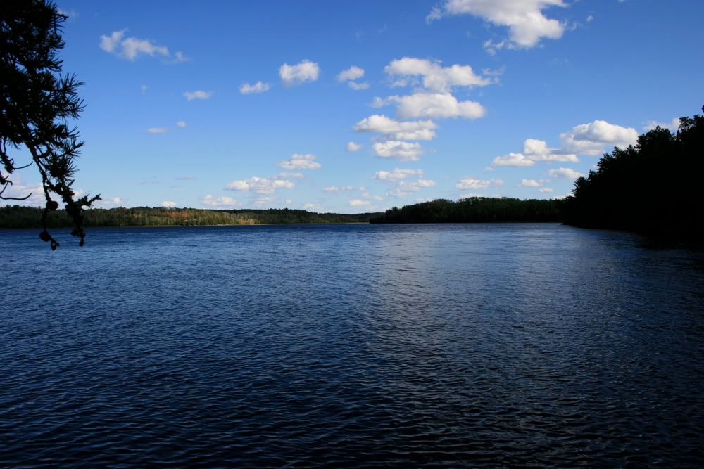
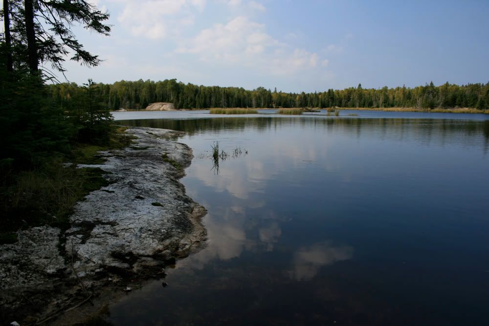
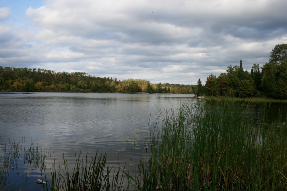
It wasn't all that bad (yet) and I kept close to shore to block the wind as much as possible. I made good progress and before I knew it I was at the narrow channel between Sullivan Bay and the Kabetogama Narrows. Almost literally before I knew it - I'm not used to large scale maps and the distance on the map seemed so much more than what I had just paddled.

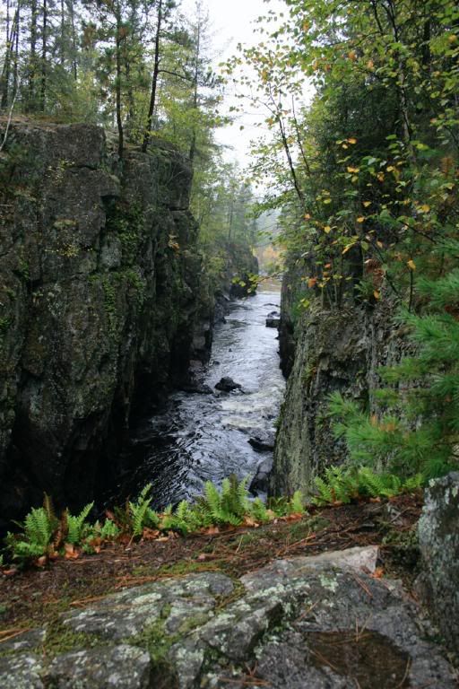
The channel was really cool to paddle through - relatively quiet, and very narrow with rocks rising up on both sides. On the way through a boat slowed down and warned me the Narrows were pretty rough. I hit the end of the channel and made my way to the shore out of the wind to look things over. I'm not even going to describe what happens when a huge boat goes by and you're sitting on shore in your kayak. It does involve getting very wet though.

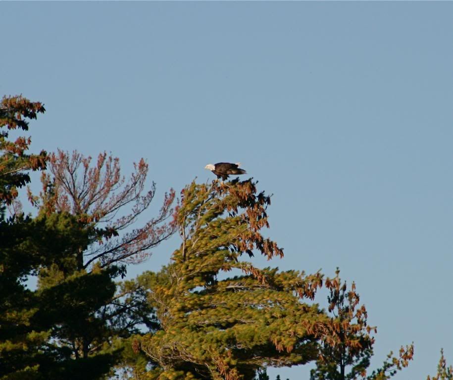
I tackled the Narrows and fought with it a bit, stopping part of the way through to plan my next line of attack. It was there that I pulled out my camera and took a few shots of a bald eagle on the opposite shore.

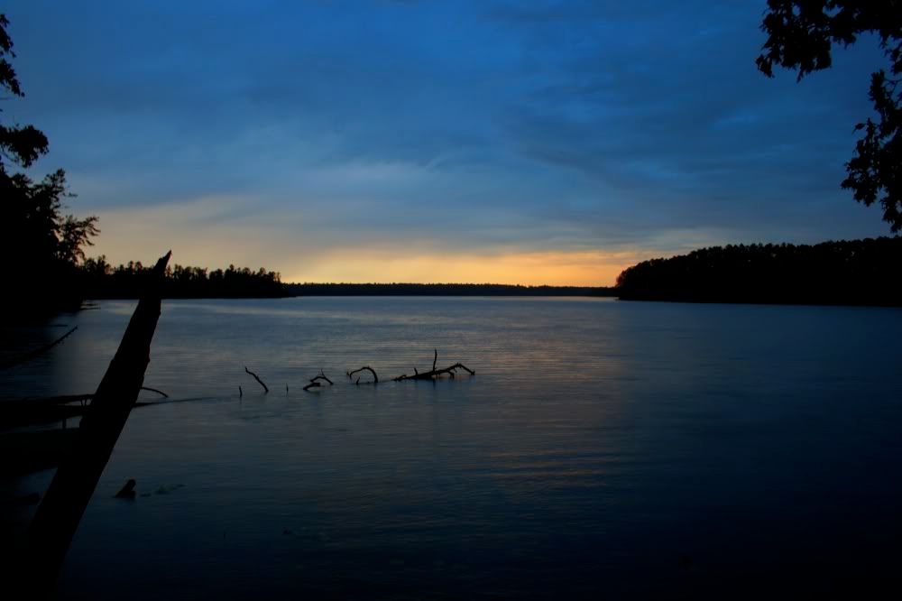
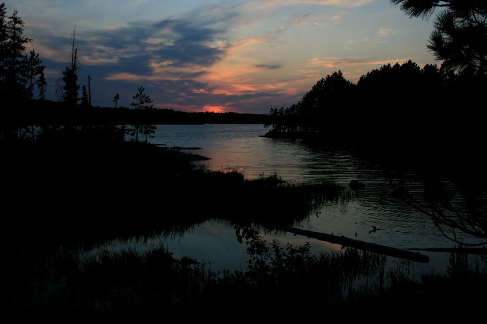
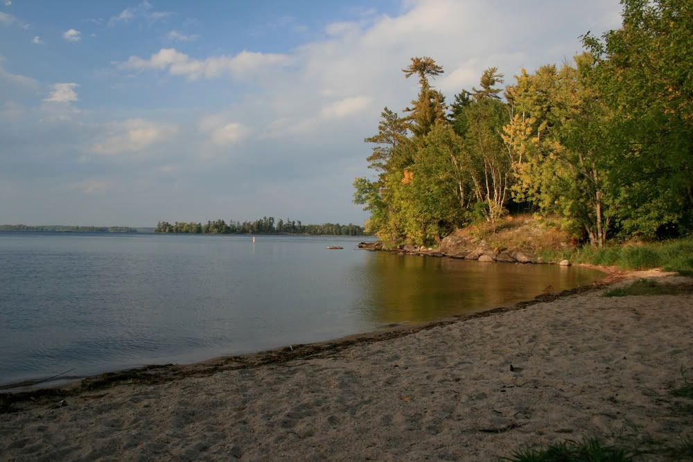
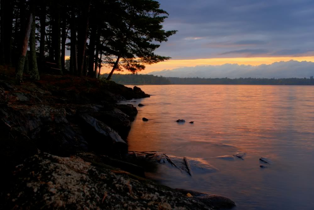
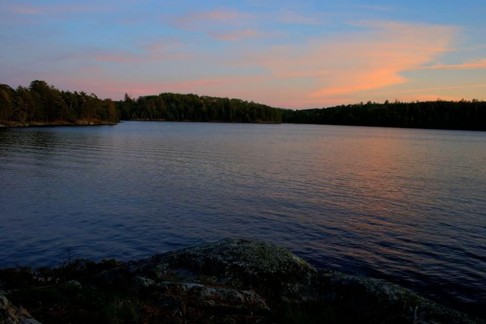
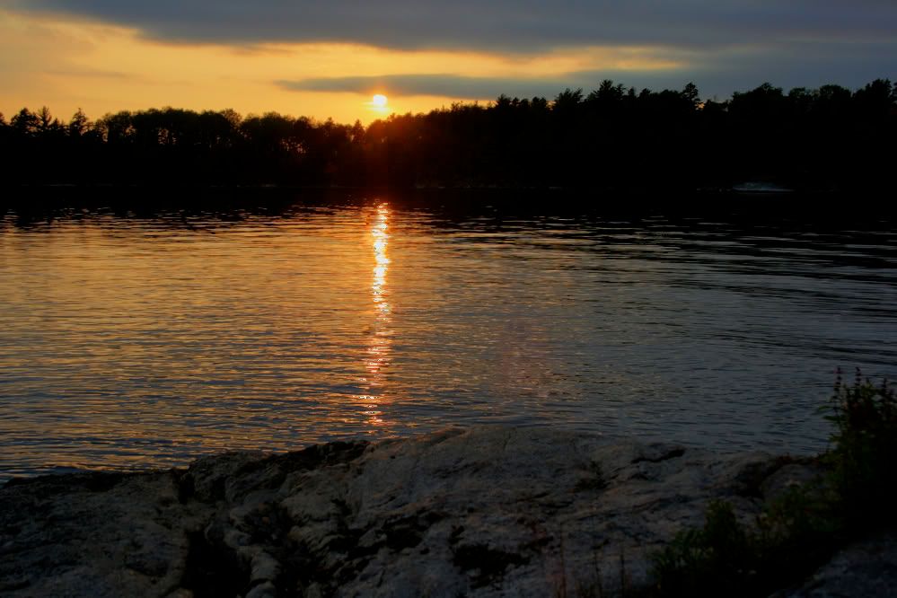
A bit wet and cold and with sunset just a couple hours away, I decided the nearest campsite was my smartest option. About 15 minutes later I was there, in dry clothes and not too much worse for the wear. I had made about 6 miles in 2.5 hours of paddling, not bad for my first time. I also decided paddling the Narrows in that kind of wind was pretty darn stupid, given my lack of experience and less than stellar kayak. The campsite was alright, not as far into the park as I had wanted but it would have to do. At least I had decent sunset views.

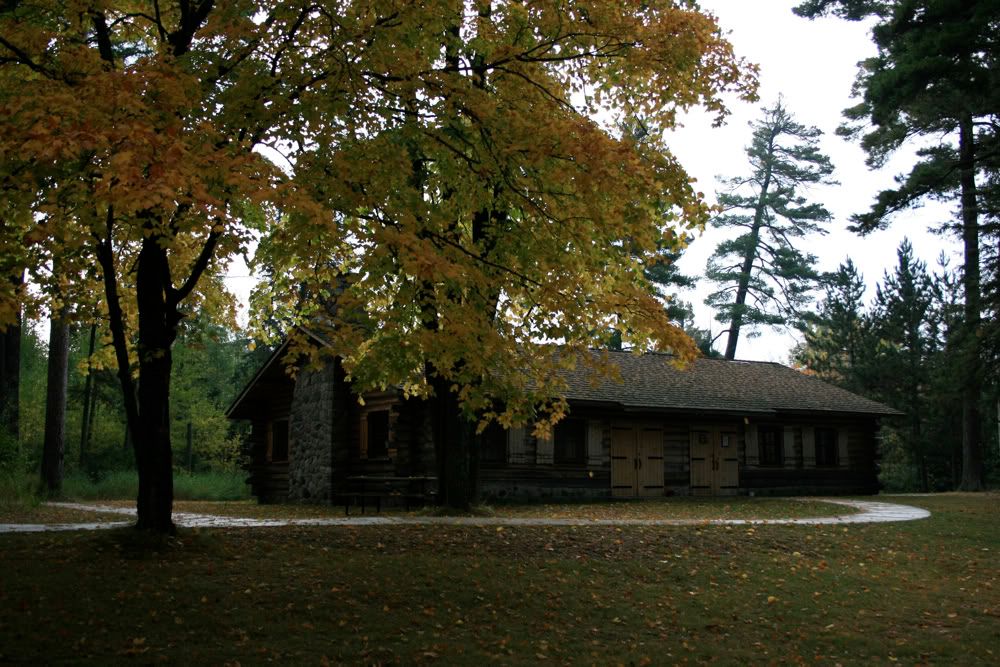
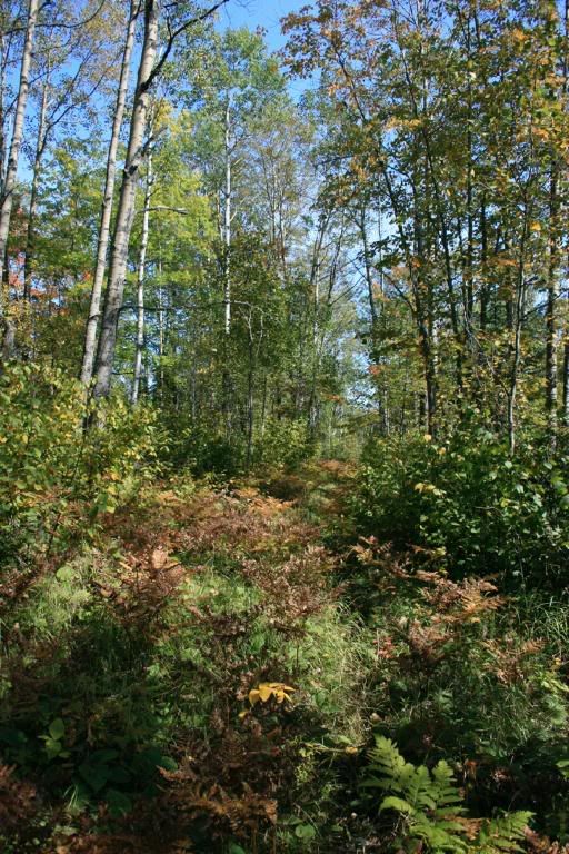
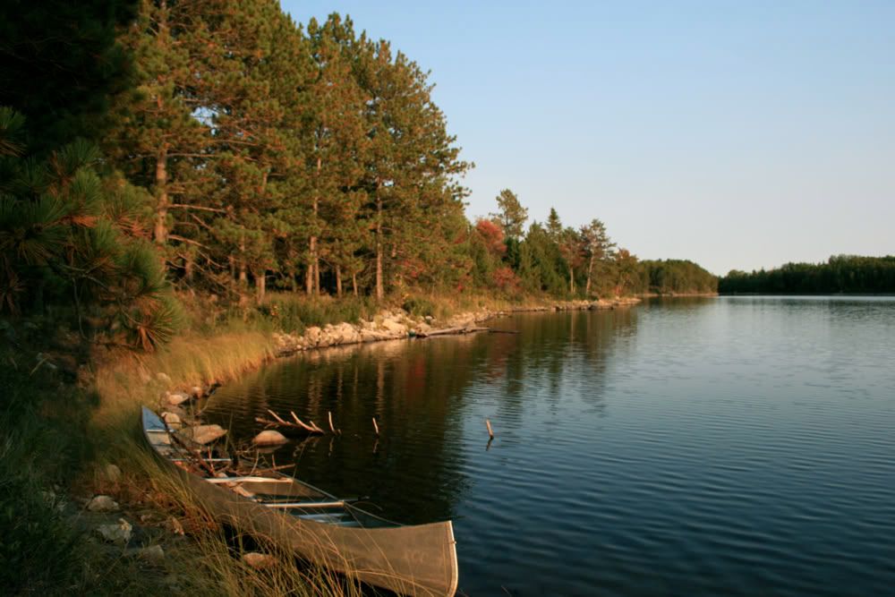
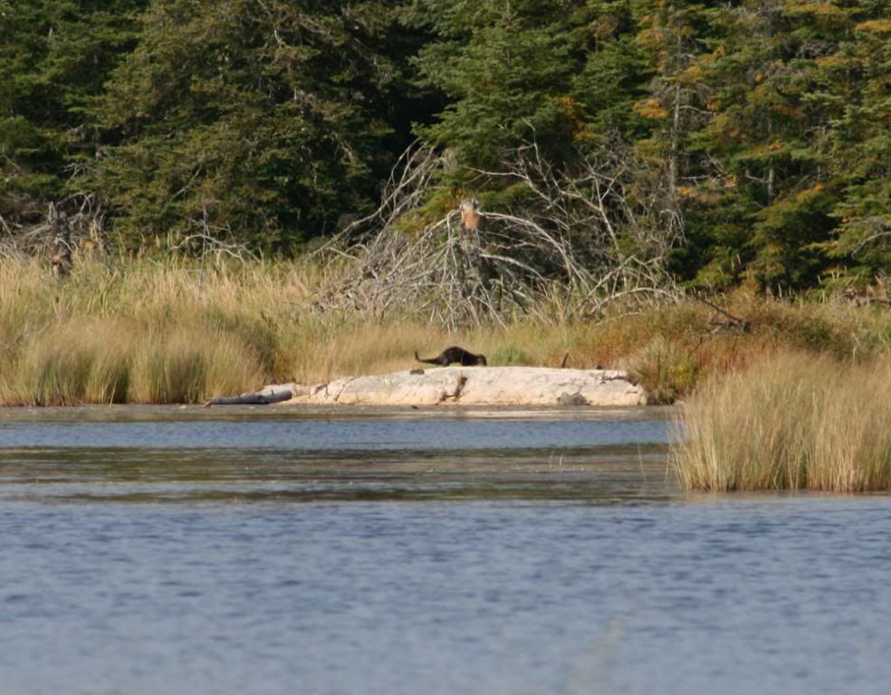
 The wind died down right after sunset (perfect timing) and picked up the next morning right after sunrise. I had a much easier time of it this day though, as I had no major crossings and was able to stay out of the wind for the most part. I was still along a major boat channel so there was quite a bit of traffic. I meandered around a bit, then went back to camp and ate lunch before paddling a bit more. I checked out the nearest portage trail and walked over to Kohler Bay to see what that was like. The trail was a little wet but very short - kind of wish I had just portaged it in the morning and paddled around in Kohler as it was much quieter than the main lake. I'm not sure which shot of the bay I like better, so I'm putting both of them up.


I headed back to camp and packed up some, then ate my dinner. The winds had calmed down at this point and I thought about packing up everything and paddling across the Narrows to Sullivan Bay. I knew the forecast for the next day called for 10-20 mph winds and thunderstorms, and I did not want to get stuck crossing that stretch of water in bad weather. By now, I had maybe 1.5 hours of daylight left, so I decided to stay put and just get up early and try to beat the wind. Had a nice quiet sunset that night. 


A thunderstorm rolled through around 4am, then all was quiet. I was up by 6 and ready to go shortly after 7am. The water was perfectly calm and I was off. As I rounded the point and headed into the Narrows, I could see several miles of calm water in front of me stretching into Kabetogama Lake. It truly was a beautiful sight, probably one of the best views of the whole trip. And I have no pictures, because at that moment a thunderstorm was slowly moving across the lake in my direction, with flashes of lightning every couple of minutes. Not wanting to be on the water with lightning about, I stuck as close to shore as possible and paddled like a madman. In no time I was through the Narrows and into the channel leading to Sullivan Bay, with lighter skies dead ahead.

Unfortunately, the storm was faster than me and with the lightning strikes getting closer I had to get off the water. I pulled up on shore and tried to get as far from the tallest trees as I could., then spent the next 40 minutes huddled up hoping the storm would pass quickly and clear skies would roll in. Hail rolled in (quarter-sized) but no clear skies. As the rain let up, I contemplated a dash to the Visitor's Center, maybe a half mile away. With lightning still flashing I was reluctant to abandon the shore. And just then a houseboat appeared. A houseboat that was headed to the same place I was going. After some gesturing and a little bit of shouting, they stopped and just like that I was on the boat with my kayak on board, not quite believing how lucky I was to be out of the storm. (Yay for Dani and Kevin, my houseboat rescuers!) Not sure if I'll ever get that lucky again, so don't look for me to try to outrun any storms in the future. The rain finally stopped about 3 hours later.

Despite all that, there were some moments (even hours) of great paddling and I definitely want to make another kayaking trip up to Voyageurs. Experience is a great teacher, and I need some more of that before I take on a trip like this again, but I will be back.

More kayaking pics are here.


Voyageurs National Park - Cruiser Lake backpack

Since my March snowshoeing trip to Voyageurs, I've been thinking about and planning another vacation to the park. I had stayed at a lodge one night when it was too cold (20 below) for me to camp, and one of the owners mentioned fall is the best season to visit - nice weather, fewer people and great fall colors. I'd heard good things about backpacking the Cruiser Lake trail and kayaking, so I decided to take a week off and do both.

My original plan was to start with 4-5 days of kayaking followed by a few nights on the Cruiser Lake trail. As usual, my plans changed. I was driving up to Duluth to spend the night before heading to Voyageurs when I saw the nearly full moon rising above the trees, glowing orange and red. Right then I decided to do the Cruiser Lake trail first to give myself the chance to see and photograph moonrise from Anderson Bay. This also seemed like the safer plan, as I was coming to realize I wasn't at all prepared for a 4-5 night kayak trip, but I felt I could easily pull things together for a backpack trip and deal with the kayak prep later in the week.

Voyageurs is very much a water based park - there are 4 large lakes that make up most of the park boundary. In order to get almost anywhere in the park, you need a boat. In order to get to the Cruiser Lake trail, I called a resort and arranged for a water taxi to drop me off at one trailhead and pick me up several days later at a different trailhead.

My plan was to get a ride to the Beast Lake trailhead on Mica Bay, hike to the intersection with the Cruiser trail and head up to Anderson Bay, and then take 2 more days to backpack down to the Lost Bay trailhead. Anderson Bay features a great overlook of Rainy Lake, and I wanted to be there for sunset and sunrise (and moonrise as long as I didn't chicken out and get scared of the dark). This map will help put things in perspective.

Unfortunately, this all fell apart almost instantly. My water taxi ride had never heard of the Mica Bay drop-off point, didn't know where it was and had no idea if there was a dock there. The ranger who issued my permit wasn't sure on the dock situation either, so I was left with 2 options: 1) drop-off and pick-up at Lost Bay, which meant almost twice as much mileage in order to see what I wanted to see, or 2) take my chances and hope there was dock at Mica Bay and if not, take my chances on wading to shore with my gear and hope I didn't slip in the water and injure myself. I went with option 1B - drop-off and pick-up at Lost Bay, with 2 nights at Cruiser Lake and a possible dayhike to Anderson Bay. Not really what I was hoping for, but I was pretty sure Anderson Bay wasn't going anywhere and the moon would continue to rise at regular intervals, so I figured it was a pretty safe bet I would get the chance to see it some day.

The hike to Cruiser took a little longer than I hoped and wasn't incredibly scenic. Other than a few ridges, it's mostly in the trees with limited views. I did have one exciting moment, courtesy of a grouse that flew up in front of me in a rather dense/dark section of trail. I do believe that's about the loudest I've yelled (it was NOT a scream) in quite some time. Not sure what my heartrate was, but it was up there. I made it to Cruiser just before sunset and took a few photos before throwing up my tent and unpacking in the dark. The campsite at Cruiser is pretty cool - it's on a little island separated from the mainland by a marshy area with a short boardwalk providing access.


I took way too long to get moving in the morning, and consequently never made it to Anderson Bay. Perhaps that's just as well - it would've been a 10 mile roundtrip, and I'm not sure I was really up for that. I hiked to somewhere around the Brown Lake trail and turned around after searching in vain for that trail. There's supposedly a sign for it, but I went back and forth 3 times in that vicinity and never saw a sign or trail. The Cruiser Lake trail itself is lightly travelled and fairly overgrown in spots, so I suppose the trail to Brown Lake is pretty faint. The shot below is a section of trail just north of Cruiser Lake.


Back at Cruiser, I pulled out the canoe and went for a paddle. Winds were light so I had little difficulty going solo. Canoeing is one of my favorite things and it was a perfect way to spend a couple hours. Yay for canoeing! I'm pretty much a slow paddler/drifter, but I like it that way. I made it around probably about 1/2 of the lake, and stopped at the picnic site (old campsite) and picked up some wood for my campfire.
Sunset was nothing spectacular. After sitting around the campfire awhile, I went to bed and head some wolves howling off and on for about 45 minutes. That was cool!

The next day dawned cloudy with a few raindrops. I packed up and started the hike back to Lost Bay. It didn't take to to decide I really didn't care to unpack and set up camp at Agnes Lake for one night just so I could repack and hike out the following morning. I called my water taxi (yes, I had spotty cell phone signal out there) and they were free to pick my up that afternoon. That energized me a bit, as I was a bit mopey about the trip (other than canoeing) up to this point and was ready to be done with it.

A little while later I needed a food break, so I headed off-trail a ways and sat on the shore of a beaver pond to eat.

Way across the pond I spotted some movement - a black shape kind of bouncing around on a rock. Thinking it was probably an otter, I grabbed my camera and took some shots. After blowing up the photos, I can confirm it was an otter - the first time I've seen one of them in the wild. I wish it had been closer so I had better photos, but a slightly blurry otter photo is better than nothing.

From there, it was an uneventful hike to the trailhead. My ride showed up about 5 minutes after I did and I was soon back on the mainland.

Side note: A couple days later a volunteer at the visitor center confirmed there was indeed a Beast Lake trail with a dock at the trailhead, and mentioned the section from there to Anderson Bay is the most scenic part of the trail. That's all I need to convince me to go back, but next time I'll be better prepared and make sure I have a shuttle that knows where to drop me off.

You can see more photos from the Cruiser Lake trail here.

If you want to see photos from the March trip, there are 4 albums here.

Voyageurs - mainland dayhikes

After Cruiser Lake, I got a bite to eat and grabbed a campsite at Woodenfrog Campground on the shores of Lake Kabetogama. The campground is part of Kabetogama State Forest and not part of the national park - the park boundary is the shoreline. I think there were maybe 5 occupied sites out of over 60. Since it's right next to the park, it has great views and easy access to the lake. The beach is gorgeous but the water was freezing.

And speaking of freezing water: I had the bright idea to use my sun shower and clean up in the campground. I thought it took an hour to heat up, but later realized it was actually 3 hours and decided to give it a try anyway. It was not a pleasant experience.

With a sketchy forecast in the morning calling for a good chance of rain for the next 2 days, I decided to postpone kayaking until the weather cleared up and do some dayhikes on the mainland instead.

My first hike was the Echo Bay trail, which is probably more popular as a cross-country skiing trail than as a hiking trail. No great views, just an interpretative trail through the woods with an overlook of Echo Bay (really more of a marsh than a bay). I was hoping this time of year would be perfect for fall color, but I was at least a week too early for peak color.


From there I headed to the Ash River section of the park and hiked the Blind Ash Bay trail. I had snowshoed most of this trail in March and wanted to see it in a different season. It has a couple nice overlooks of Lake Kabetogama but is mostly in the forest. Again, fall colors were OK but not spectacular yet.

The main overlook at the mouth of Blind Ash Bay is awesome. For comparison's sake, I put in a similar shot from March.


In March I lost the trail beyond this point, so it was nice to be able to complete the full loop this time around.

Later I relaxed at the beach for awhile, then headed off to bed. Except for the car that drove through the campground twice at about 10:30 and an early morning thunderstorm, it was an uneventful night. The car did freak me out - it drove around my loop twice as if they were looking for someone but never did stop. Which is a good thing, because I was about ready to bolt for the Jeep if they slowed down or stopped near me. There was no one else on my loop and the closest campers were completely out of sight and earshot, so I was more than a little uneasy about a late night drive-thru.

Morning brought more rain, which meant it should've been a good day for a waterfall hike. I went down to Crane Lake and hit the Vermillion Gorge and Vermillion Falls trails. The skies opened up just as I hit the Gorge trail and it rained most of the time I was on the trail making photography difficult and changing lenses next to impossible. The gorge itself was cool, the rest of the hike was a wet slog through the woods. At least there was some decent color.


There are also some interpretative signs along the Gorge trail, relating the history of the area (and there's a lot of history to be told). The falls trail is several miles away and quite a waste of time. There's an overlook directly above the falls, from which you can see almost nothing of the water. Below that about 50 feet is a better view, but nowhere can you see the entire 10 foot waterfall unless you jump out into the river. This picture shows maybe half of it:

After driving back to Woodenfrog and watching a great sunset, I got creeped out thinking about the car driving through the night before. People scare me more than animals. Since everyone else had checked out of the campground and I was alone, I decided to get out of there and get a hotel room in International Falls for the night. That also gave me the chance to dry out some of my gear and repack for the kayaking part of my trip.


My dayhike photos are here.

Friday, September 12, 2008

Russians at the zoo


We finally went to see the new Russian Coast exhibit at the Minnesota Zoo. It opened in June but I avoided the zoo all summer because of the crowds. The brown bear section is really well done. Sea otter exhibit - OK, a little small but the cuteness makes up for it. Wild boars and Amur leopards - not very creative and too small. Seeing ten wild boars milling about on what is essentially a sandy dirt lot with a few logs scattered about doesn't make for much of an exhibit. The leopard exhibit was a typical big cat pen - a few rocks to walk around on, some vegetation and entirely too small, much like the mountain lion enclosure on the Minnesota Trail. I did get some decent close-up shots of the leopard.

We finally saw the baby takin. It was born earlier this year while we were at the zoo and we managed to miss it. Despite me saying it looked like one of the takin was about to give birth, and even though we wandered around for another 1.5 hours and saw a news crew just outside the zoo as we were leaving, I didn't figure out what happened until I read about the birth online that afternoon. That would've been about the coolest thing to see, but instead we're forced to settle for a photo of it several months later. Not quite the same.

In other news, the meerkats are getting a new home, the Minnesota Trail beaver still hasn't woken up and emerged from its lodge while I've been there, and there's a temporary African exhibit coming next summer. Yay for meerkats!

Sunday, September 7, 2008

Black Dog Preserve

I thought about doing the usual visit to the wildlife refuge today (the Long Meadow unit of the Minnesota Valley National Wildlife Refuge), but since it's fall and the prairie flowers are in bloom I opted for the Black Dog Preserve. It's about a 20 minute drive from home, a very welcome change from the 4+ hours of driving the past couple weekends. 

There's only one 2-mile trail in the Black Dog, and it doesn't look like it gets a lot of use based on the overgrowth in the initial stages. There were some good views and lots of flowers to be seen.


At about the halfway point, the trail opens up as Black Dog Lake comes into view on the left, with a small pond/marshy area on the right. There were a bunch of frogs jumping off the trail and splashing into the pond, a little muskrat house, a few deer and lots of birds. And snails. I stopped once to look at something on the ground, then noticed a snail slowly moving across a leaf. As I watched it, I saw more and more snails around me. It's really cool watching them inch their way along, eating bits of grass and such.


And that pretty much concludes my hike. With only 2 miles to walk there's not a great chance of seeing something exciting like a bear or wild muskox, so I settled for lots of flowers and snails, and butterflies. 

As always, the rest of my photos are here. 

Tuesday, September 2, 2008

Bears and wolves and foxes

We're back from the long Labor Day weekend. I'm happy to report that we didn't get eaten by any of the animals mentioned in the title, because that would've hurt a bit and screwed up my vacation plans for later this month.

Saturday morning we got up (not early enough) and drove to Duluth for their Pride festival. Let me rephrase that: we drove to Duluth so Terp could interpret at their Pride festival while I mostly avoided it by finding mundane things to do (got the oil changed in his car, checked into the hotel, take a nap). I did show up for a little while to see Martha Wash sing, and that was the extent of my attendance at Pride festivals for the year. I will say that Duluth has a nice setting for their festival, right on the harbor with a nice view of the lift bridge.


On Sunday morning we took the somewhat scenic route out of Duluth (Skyline Drive) and headed up the North Shore scenic drive. Along the way, we had breakfast at the Lakeview Castle (it was good, especially the bacon!) before continuing on. Beyond Two Harbors, we had to stop at Palisade Head - this is a small detached unit of Tettegouche State Park perched on top of the cliffs overlooking Lake Superior. I found an odd looking creature sitting on the rock wall. I took its picture, and then it kept following me the rest of the weekend.


From there, it was a long and winding road through Superior National Forest to Ely, the gateway to the Boundary Waters. The BWCA was not our destination though, as I have no real desire to portage a canoe and Terp has no real desire to be out in the wilderness to that extent. We camped 2 nights at Bear Head Lake State Park - we didn't see a bear head but did see a lake. On a side note, this is the same park I overnighted at in March as part of my winter camping expedition. You can see photo from that trip here if you're interested. (The BHLSP photos are a sub album under the Voyaguers album in case you're confused)

Anyway, in Ely we went to the International Wolf Center and the North American Bear Center. They were both cool, but I think it's a 2-0 vote in favor of the bears. Terp thinks wolves are just kind of like big dogs, and I would've been more excited if we could've played with (or even seen) the wolf pups. It didn't help my opinion that there were 2 arctic wolves that seemed very much out of place in Minnesota.

Meanwhile, at the Bear Center we walked in right as Ted and Lucky were walking around the viewing window/platform. Ted was raised by humans and is possibly the largest black bear in the world. Seriously. He's estimated to weigh 950-1000 lbs. Lucky is just a little guy born last January. Some people took him from his den when he was a cub to raise as a pet. Once they figured out he was too much for them to handle, they had to get rid of him. Unfortunately, he had already bonded with humans and wasn't a candidate to be released into the wild. Wisconsin DNR officials contacted the Bear Center and asked if they could take him, and lucky for him they agreed. He weighed 10 lbs. at the time, and about 14 months later he's grown quite a bit.


Honey also lives there. She was raised by the same couple that raised Ted, and arrived with him in April '07, shortly before the Bear Center opened it's doors to the public. I'm betting we'll figure out a way to go back up there next summer and see the bears again.

After hanging out there as long as we could, we drove to the state park and set up camp. The campgrounds were full but fortunately pretty quiet, possibly because we were in the RV section and most of them sit inside at night. We took a short walk through the woods and down to the beach for a nice sunset view.

The weather was unusual - a steady south wind kept the temps in the upper 80s during the day and mid-60s at night. We opted to keep the rainfly off the tent so we could see the stars, and Terp saw the Milky Way for apparently the first time in his life.

The next morning was our big hike - there's a trail that has been frequented by a fox family all summer, so we walked around looking for them. Sadly, they did not show themselves, but it was still nice to be out there. Then it was time for me to go kayaking and get a feel for what I'd be doing several weeks when I go up to Voyageurs again. I did alright, although it was a little unnerving at first and the wind pretty much sucked. I think I've got a better idea of what to expect now.

We headed over to Soudan Underground Mine in the afternoon for the mine tour. The tour takes you 2341 feet underground in a little cage - the same cage the miners used to ride to get to work every day.
Once down there, it's a brisk 50 degrees, which isn't so bad except on the 3/4 mile train ride to and from the mining site. We got to wear rockin' cool hard hats and saw a few stray bats, which managed to scare some of us (namely myself and the woman sitting across from us). Our guides did a good job and were very informative and entertaining. We even got a quick peek at the underground physics laboratory.

Back up top, we headed into town for some pizza. We drove around town a bit (which confirmed Terp's belief that he would die if we ever lived in Ely), and also visited Jim Brandenburg's gallery and a local paddling shop/bookstore. I looked around the downstairs at all the stuff I would need for kayaking, while Terp went to the upstairs bookstore and read for awhile.

Once back in the state park, we came around a bend in the road and there stood Mr. Fox, right about where we went hiking in the morning. He didn't seem a bit concerned with having an audience as he trotted back and forth, up and down the road for about 15 minutes before disappearing into the forest.
After a brief bit of kayaking before sunset, we sat around the campfire awhile and then got to sleep. The real world awaited as we had to be on the road by 8am so I could make it back for work, but hopefully we'll get back up there next year and have a chance to visit the area again.


You can see all the photos here.