I had never made it past the turnoff to Ely on Hwy 61, so most of my trip was uncharted territory. I planned to stop at several of the state parks before getting to Grand Portage. That undertaking proved a bit easier than anticipated - Saturday was the opening of the deer hunting season, and most of the state park lands were temporarily closed leaving me with few hiking options. I did make brief stops at Temperance River and Cascade River and came away with some waterfall photos. I must admit, I wasn't blown away by either park although I'm sure they are both much nicer when fully open and with some fall color on the trees. The cold temps and occasional snow flurry didn't help much.
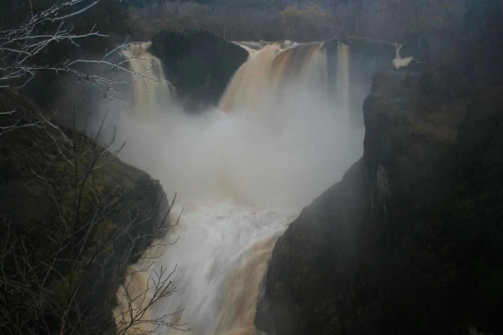
Continuing on, I made it to Grand Portage State Park before sunset and managed to get some shots of the state highest waterfall, the appropriately-named High Falls. The state park is on the Grand Portage Indian Reservation and is leased to the state by the Bureau of Indian Affairs - the only state park not owned by the state of Minnesota. It is also on the U.S./Canada border with the Pigeon River Provincial Park just across the way. I did not cross the border but did say 'aboot' and other funny Canadian words every time I could.
I wanted to hike Mt. Rose before it got dark, so I headed down to the village of Grand Portage. Mt. Rose is part of Grand Portage National Monument. I made it to the summit just before sunset and had barely enough time for a couple shots of Grand Portage Bay with the stockade in the foreground. I made my way down in the growing darkness and drove over to the Grand Portage Lodge/Casino where I was staying for the weekend. There is little to do after dark except gamble - instead of that I went up the road to the gas station and bought some food, then went back to my room to figure out what I wanted to do on Sunday.
An overcast sky in the morning meant one thing: I would go back to sleep for another hour or so instead of getting up for an attempt at sunrise photography. After a nice nap, I headed back to the state park and hiked up to Middle Falls. The falls were decent but I noticed with some chagrin I could've driven to them from the Canadian side and skipped the rather dull hike.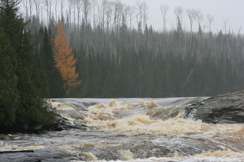
On the way back out I stopped at High Falls to attempt more photos and was driven away by the incessant mist covering everything in ice. I guarded my camera as best I could and came away with a couple shots, more interesting as comparison shots to the previous day than anything else.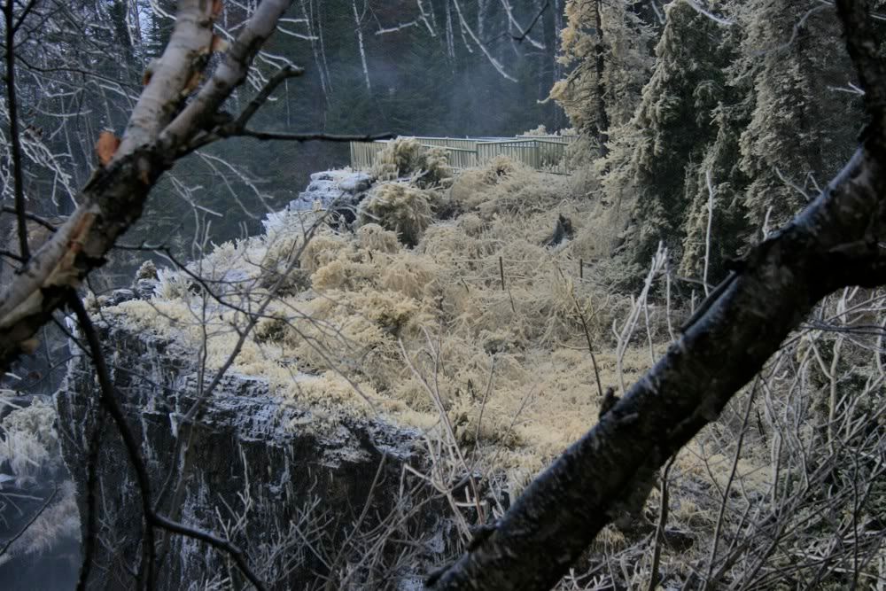
I made a semi-pathetic attempt to drive to Partridge Falls. It's located at the end of a 5 mile long 2-track road, and I gave up on that idea after maybe 100 feet. It had taken probably 15-20 minutes of driving to get to there (I saw a fox on the way!) but I wasn't up for crawling along the narrow, crappy road just to see another waterfall. Perhaps in better weather and in a better season I'll try it.
From there it was back to Grand Portage National Monument where I wandered around the outside of the stockade and tried to imagine what it was like when the voyageurs were still around. I'd really like to get up there for the Rendezvous in August if I can. I also walked up the Grand Portage trail for a little ways - another thing I'd like to do next summer. It would be really cool to backpack to Fort Charlotte and spend a night there.
Another night of excitement in the village gave way to morning and sunshine. Finally. I made a quick run up to the state park and shot a few photos of High Falls (again), then stopped off at a viewpoint on Hwy 61 and took some photos of the Suzie Islands with Isle Royale way off in the distance. Yet another place I'd like to get to in the near future. After checking out, I went back to the national monument and wandered through the visitor center. It's only open Monday through Friday in the off-season.
This is from the same spot as the first photo: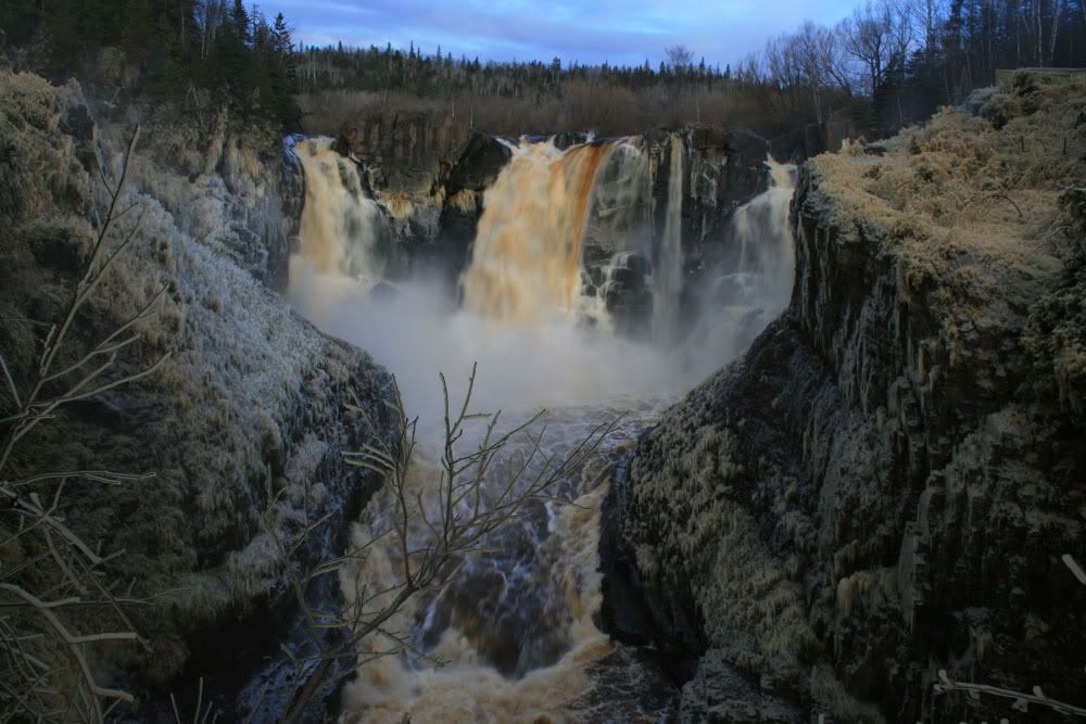
And then I was off, headed for the lighthouse. I stopped off at a State Natural Area (Sugarloaf Cove) south of Schroeder and walked around a bit. There's a short interpretive trail which is interesting, although probably more so had I consulted the trail guide. Beyond that I also stopped at Tettegouche State Park and hiked part way to Shovel Point, stopping when I was near the little arch on Lake Superior.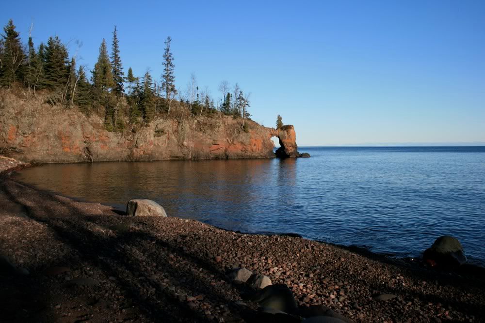
Time was on my mind so I got moving. I pulled into Split Rock with my plan already in place. I would hike up to the campsite Terp and I stayed at and wait for sunset, then take some photos and get out of there. My lord there were a lot of people there. I passed about a dozen photographers at one spot, all in a line waiting for the lighting. It seemed kind of silly and boring for all of them to shoot basically the same shot, but nevertheless they did. I wound up sharing my space with 3 other photographers, although I did make a point of staying a little ways from them. I also made a point of photographing other stuff while waiting, which seemed like a better way to pass the time than just standing there staring at the lighthouse.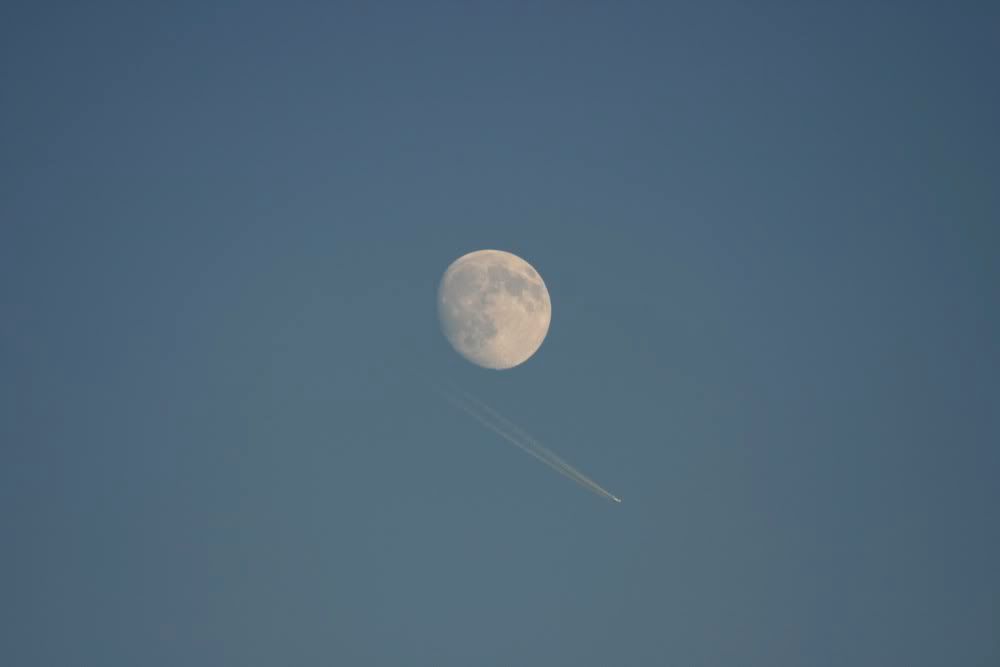
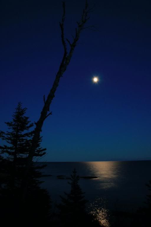
Once the moment was finally upon us, I realized it really wasn't all that exciting. Kind of like waiting and waiting for the sunset, passing up chances to do other things and then being disappointed when the sunset is a washout. But I dutifully took some shots, then took some more of the full moon over the lake before walking back to the Jeep and heading home. I did learn one thing though - shoot lighthouses when it's still somewhat light out, otherwise the long exposures necessary to get a shot make the light itself a big blur. Doubt I'll use that lesson again at Split Rock, but it may come in handy for something else.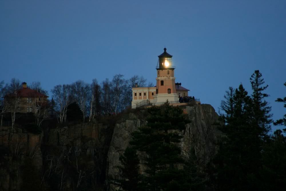
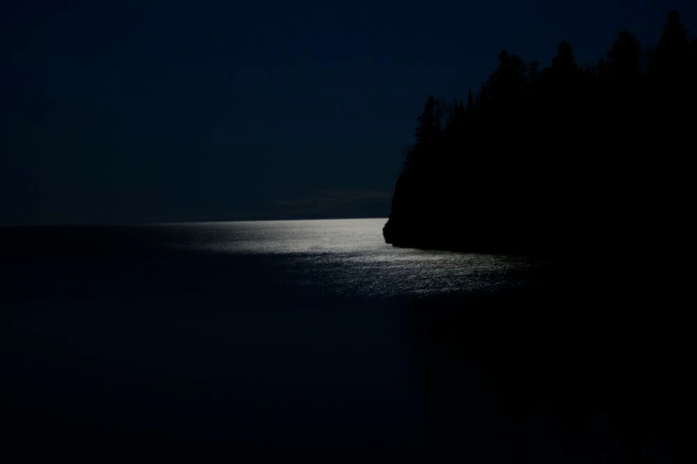
More photos from the weekend are here - 2 albums, one for the Grand Portage area and one for everything else.